Spatial Analysis: Data-Driven Transportation Planning Methods
From this semester-long course, I gained a firm understanding of the data-driven methods used by transportation planners to explore, visualize, quantify, and predict transportation and travel demand and to model transportation flows and infrastructure designs. After understanding the fundamental mathematical relationships that guide transportation flow modeling, I gained a working knowledging of the pratice from interacting with the softwares including Visum, Vissim, and the stplanr package in R.
Visum
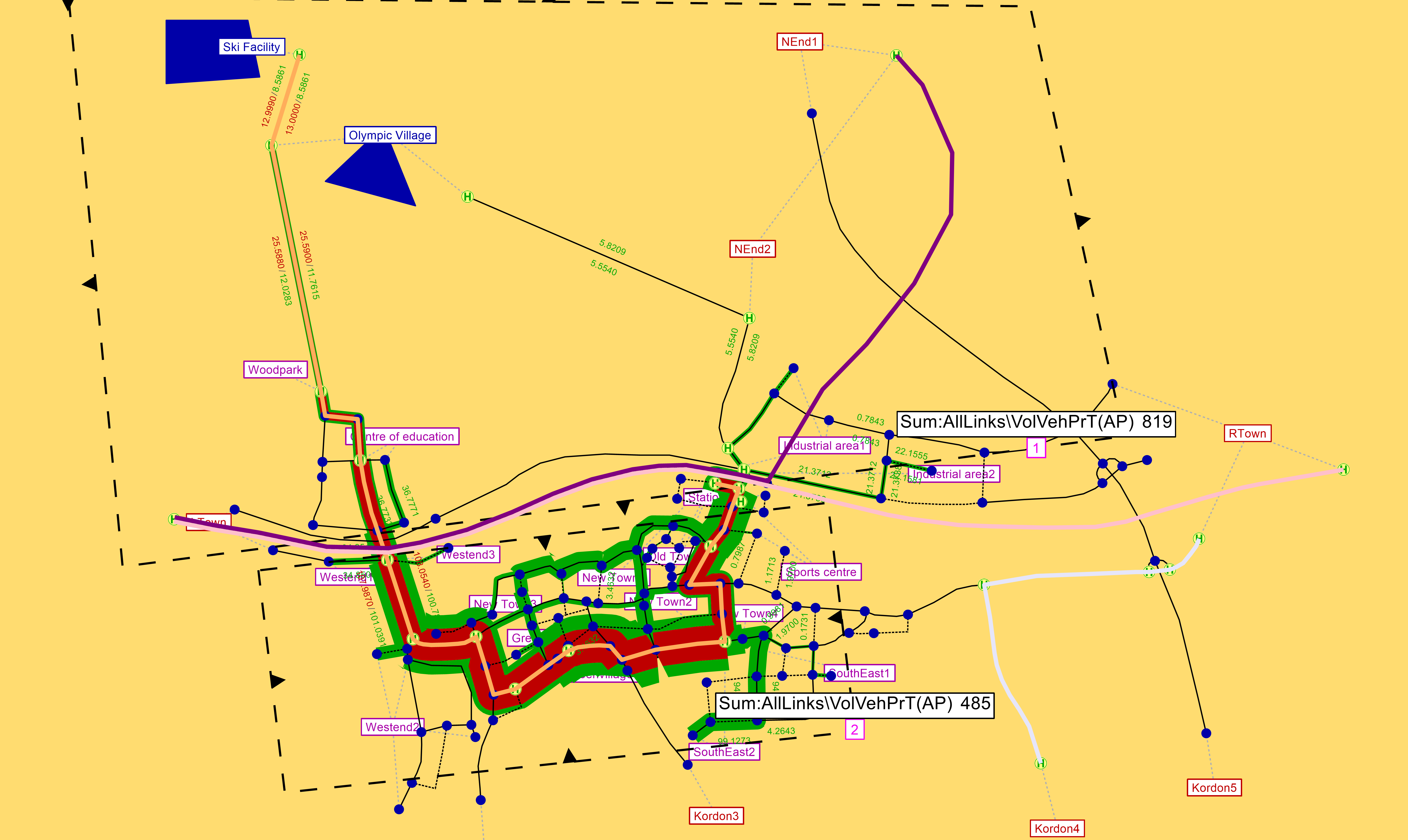
Using Visum, we investigated traffic patterns from socio-demographic adn transportation network data, created a transportation plan for new facilities, and became familiar with a real-size network model.
Vissim
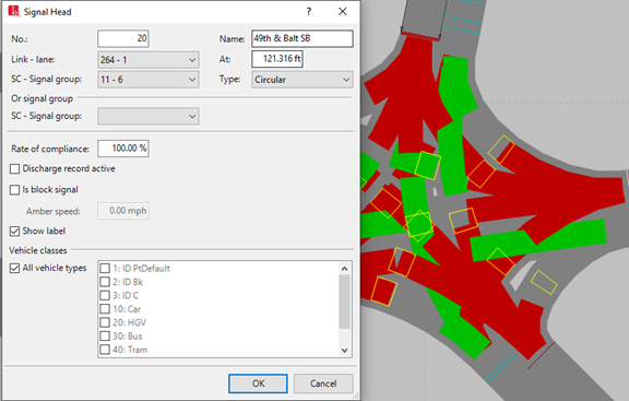
While Visum is commonly used as a regional travel demand modeling platform, Vissim is good for localized transportation flow modeling. We performed a simulation to understand how the length of green light influences travel time in a corridor network model.
stplanr
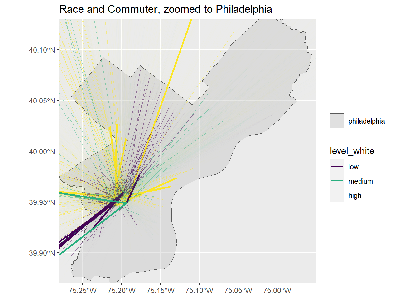
Using stplanr package, we aimed to understand the geographic distribution of workers who commute into University City with the Longitudinal Employer Household Dyanamics Origin-Destination Employment Statistics (LODES) data. Through illustrating desire lines between the O-D pairs, we analyzed patterns of median age, median income, percent taking public transit, percent white, number of jobs, distance of commute, and count of commuters of the workers flow.
disclamer: this project is a part of a graduate course