Portfolio/作品集
This page hosts some sample work of mine.
Check out the projects by categories using the sidebar on the left;
or navigate by skills using the panel on the right.
Programming
R
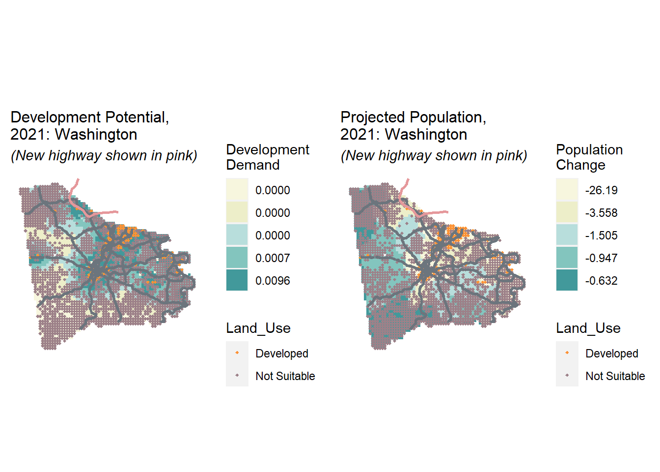
Research and Memo: Urban Growth Modeling for Pittsburgh MSA
A (fictional) growth modeling project which forecasts new development for 2021 through a binary logistic regression model
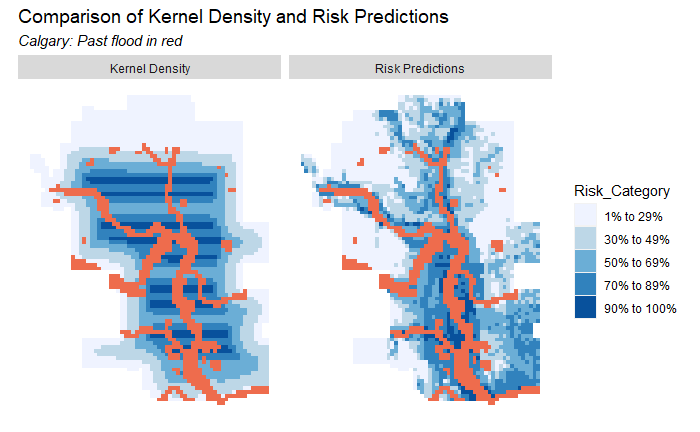
Spatial Analysis: Flood Inundation Prediction
A environmental risk model that predicts the probability that an area will be inundated with flood water
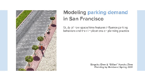
Spatial Analysis: Modeling Parking Demand in SF
A study of how space/time features influence parking behaviors and their implications on planning practice
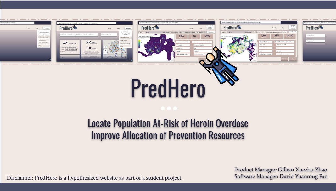
Spatial Analysis: Heroin Overdose Risk Prediction Project
A geospatial risk model for heroin overdose events for the City of Cincinnati, Ohio
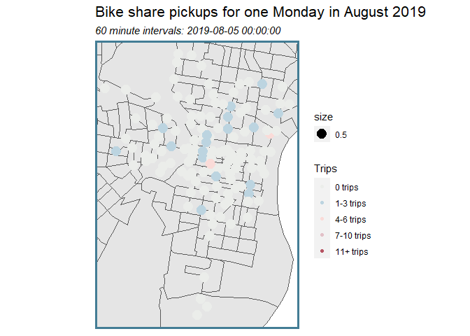
Spatial Analysis: Indego Bikeshare Prediction Project
A geospatial (+ time lag) model for an Indego bike-share prediction use case
Cost Benefit Analysis: Home Repair Tax Credit Allocation Project
A predictive model that helps identify eligible homeowners who are more likely to take the tax credit program
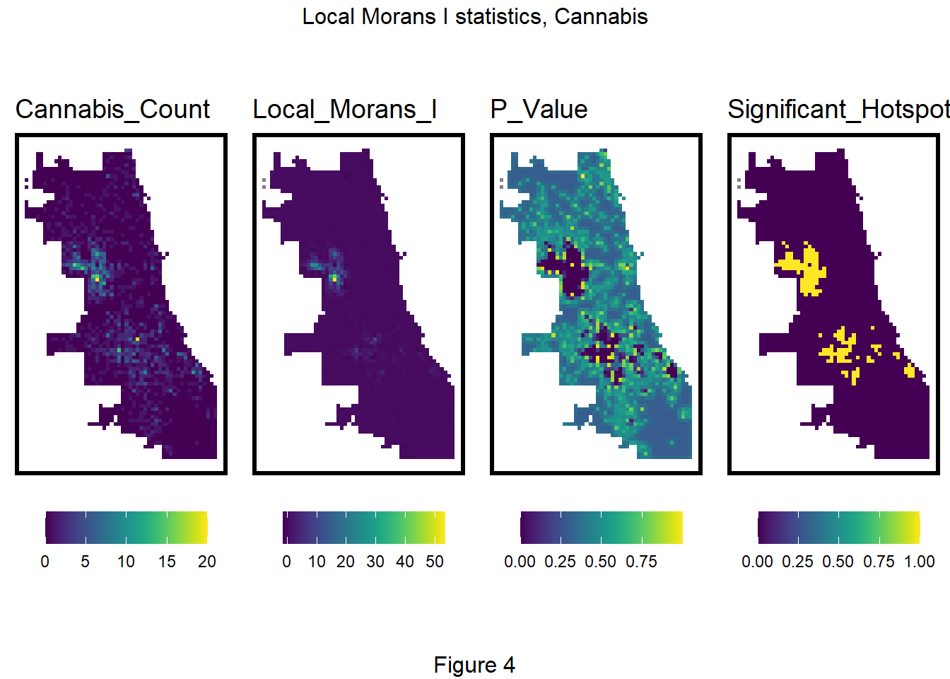
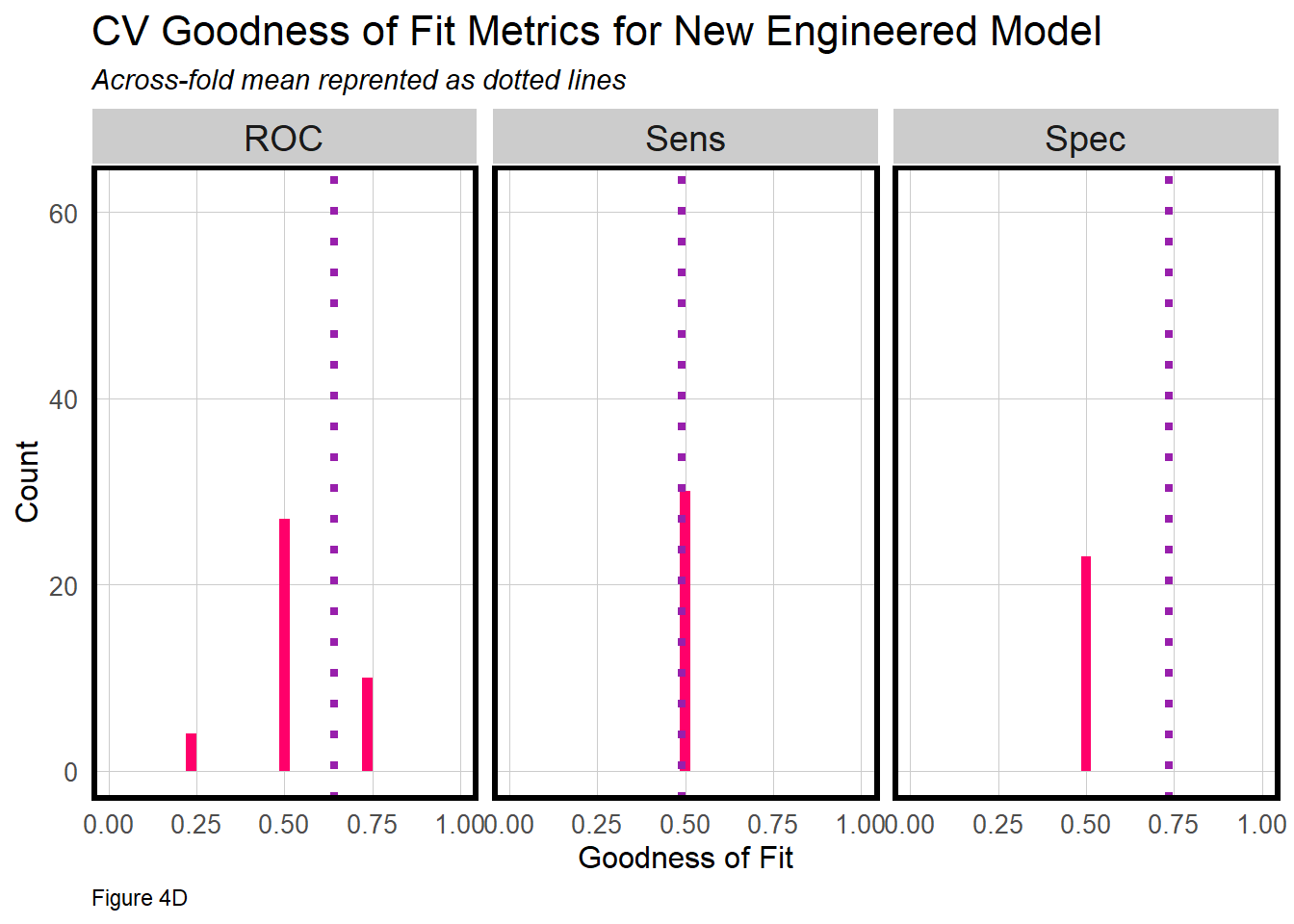
Spatial Analysis: Predictive Policing Project
An analysis that examines the accuracy and generalizability of a predictive policing model on Cannabis Possession crime in Chicago
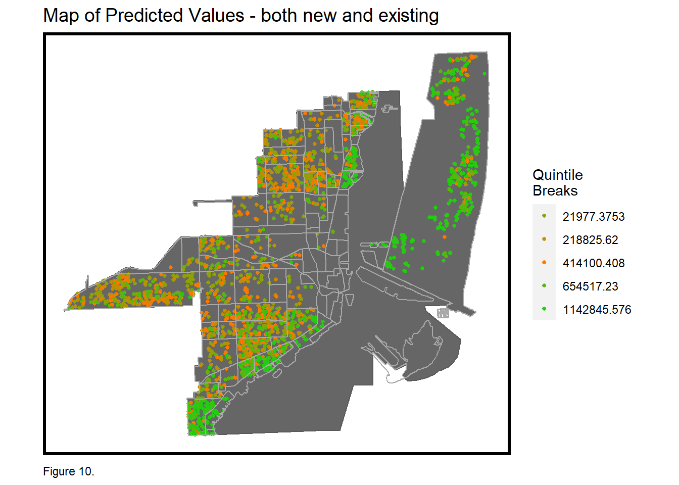
Spatial Analysis: Housing Price Prediction Project
A predictive model that factors in available local intelligence in hopes of delivering a better model for home prices prediction
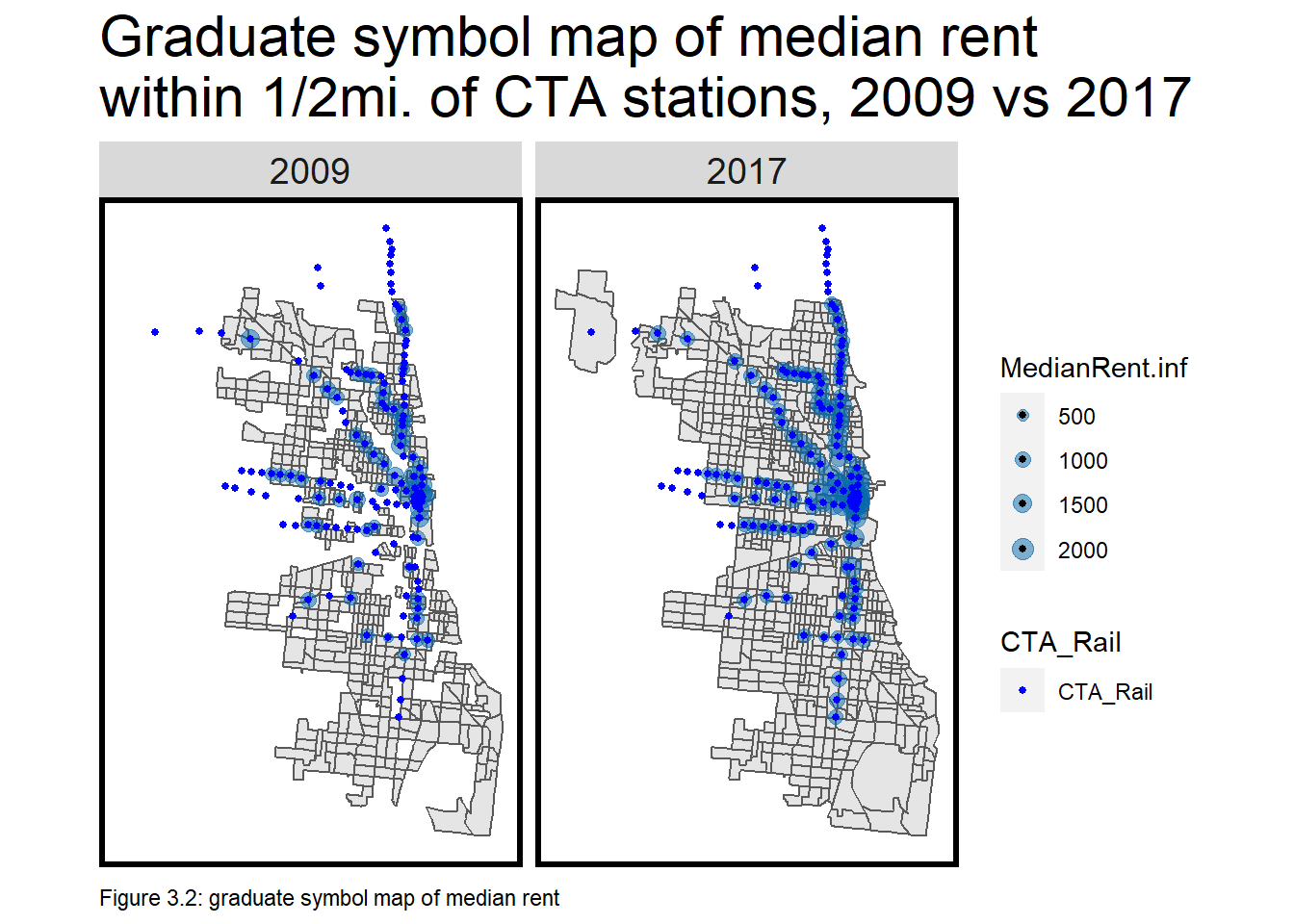
Spatial Analysis: TOD Suitability Analysis
A study of TOD through comparing data between TOD and non-TOD areas across 2009 and 2017 in Chicago
Python
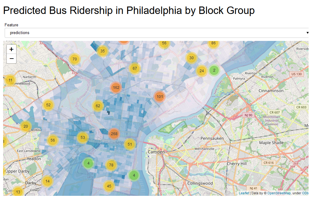
Spatial Analysis: Bus Ridership Analysis and Prediction
A set of dashboards for proof-of-concept ridership analysis and prediction
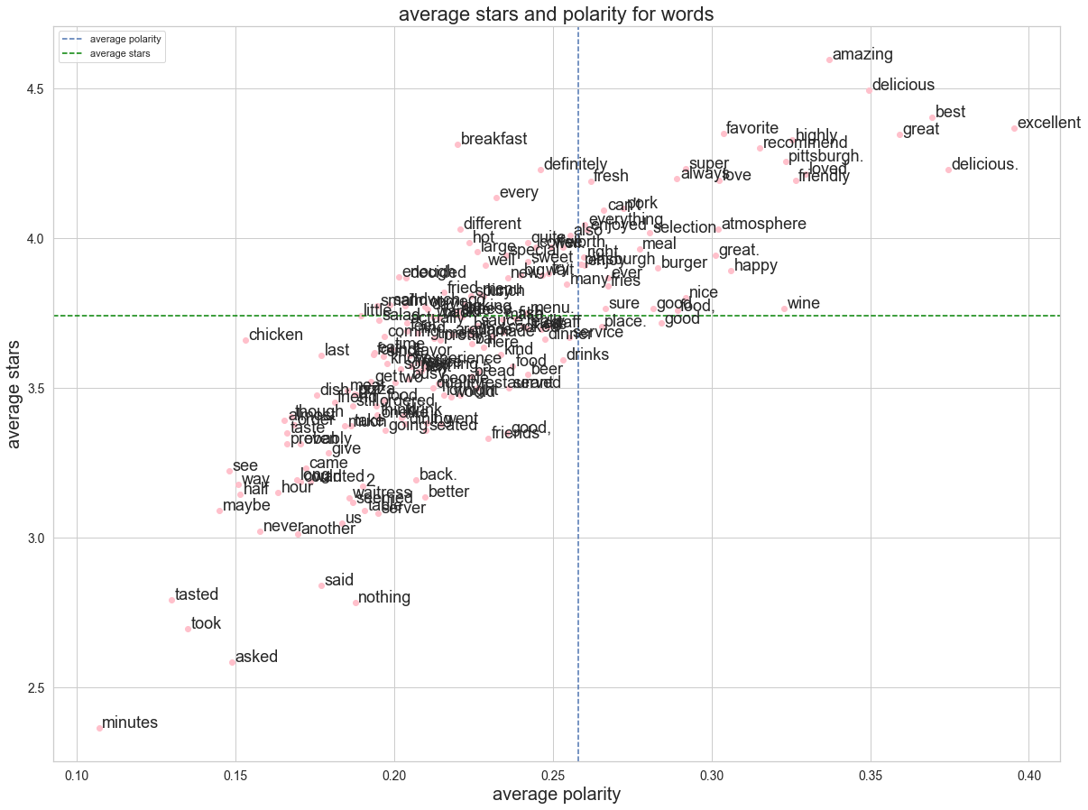
Statistical Analysis: Sentiment Analysis with Yelp Reviews Data
A short sentiment analysis using textblob and nltk libraries
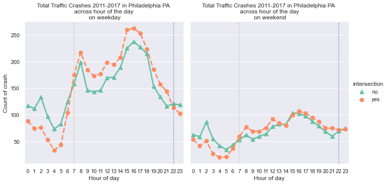
Statistical Analysis: Exploratory Data Visualization on Traffic Crashes
A short exploratory visualization using matplotlib, seaborn, and altair libraries
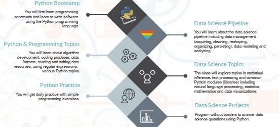
Python: Intro to Data Science
A semester of Introduction to Data Science course which trained my python and data science knowledge
Javascript
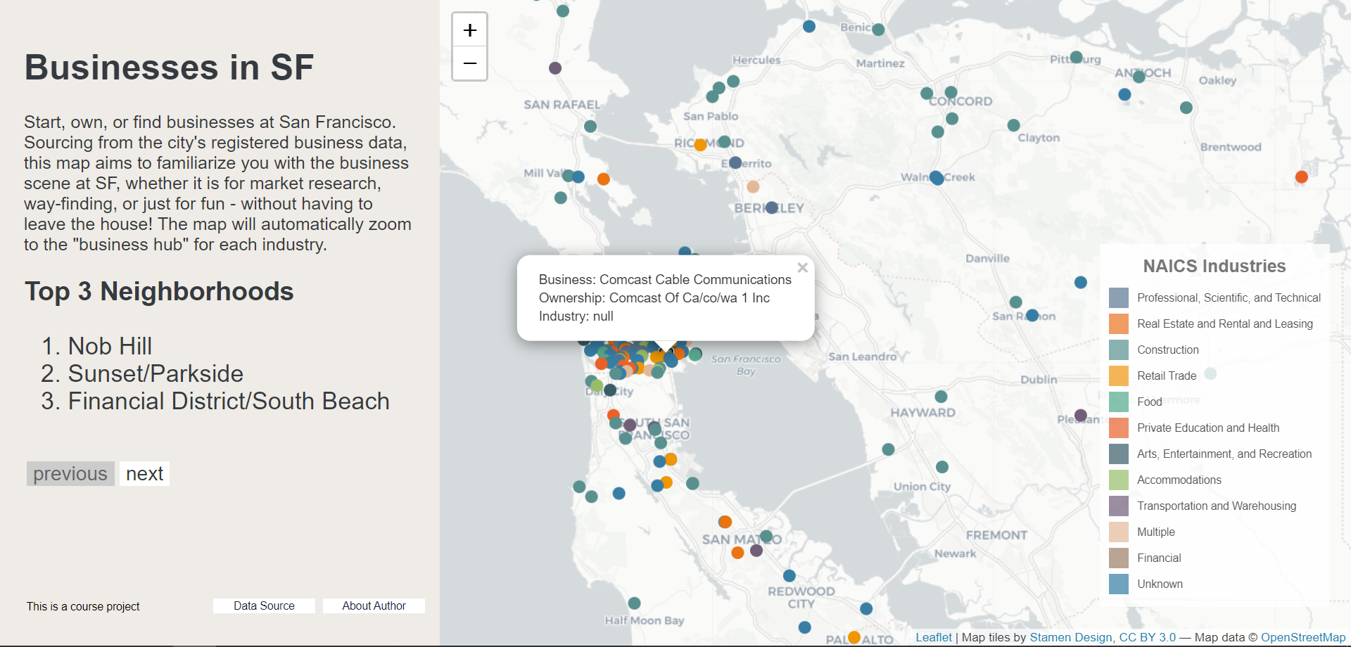
JavaScript: San Francisco Business Trends
A web map that zooms to the ‘business hub’ for each industry
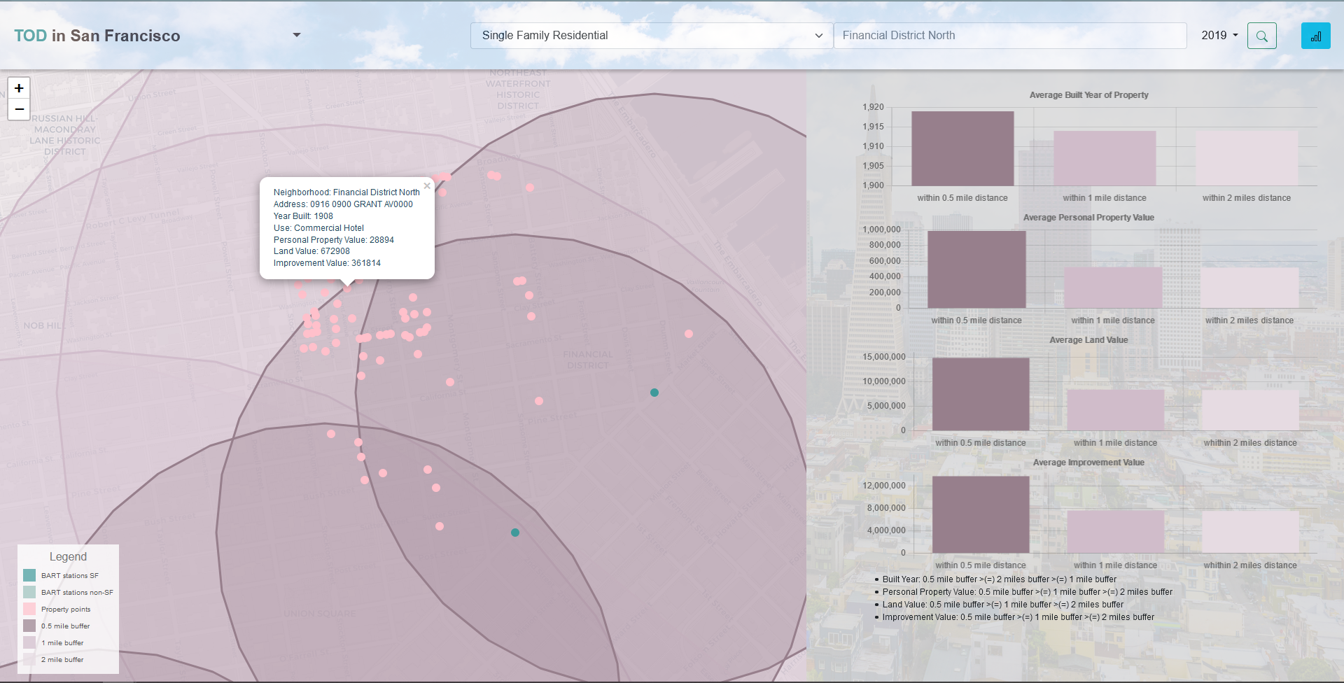
JavaScript: San Francisco TOD benchmarking
A web map that visualizes the economic impact of BART stations on nearby properties
Geographic Information System
ArcGIS
Spatial Analysis: Flood Inundation Prediction
A environmental risk model that predicts the probability that an area will be inundated with flood water
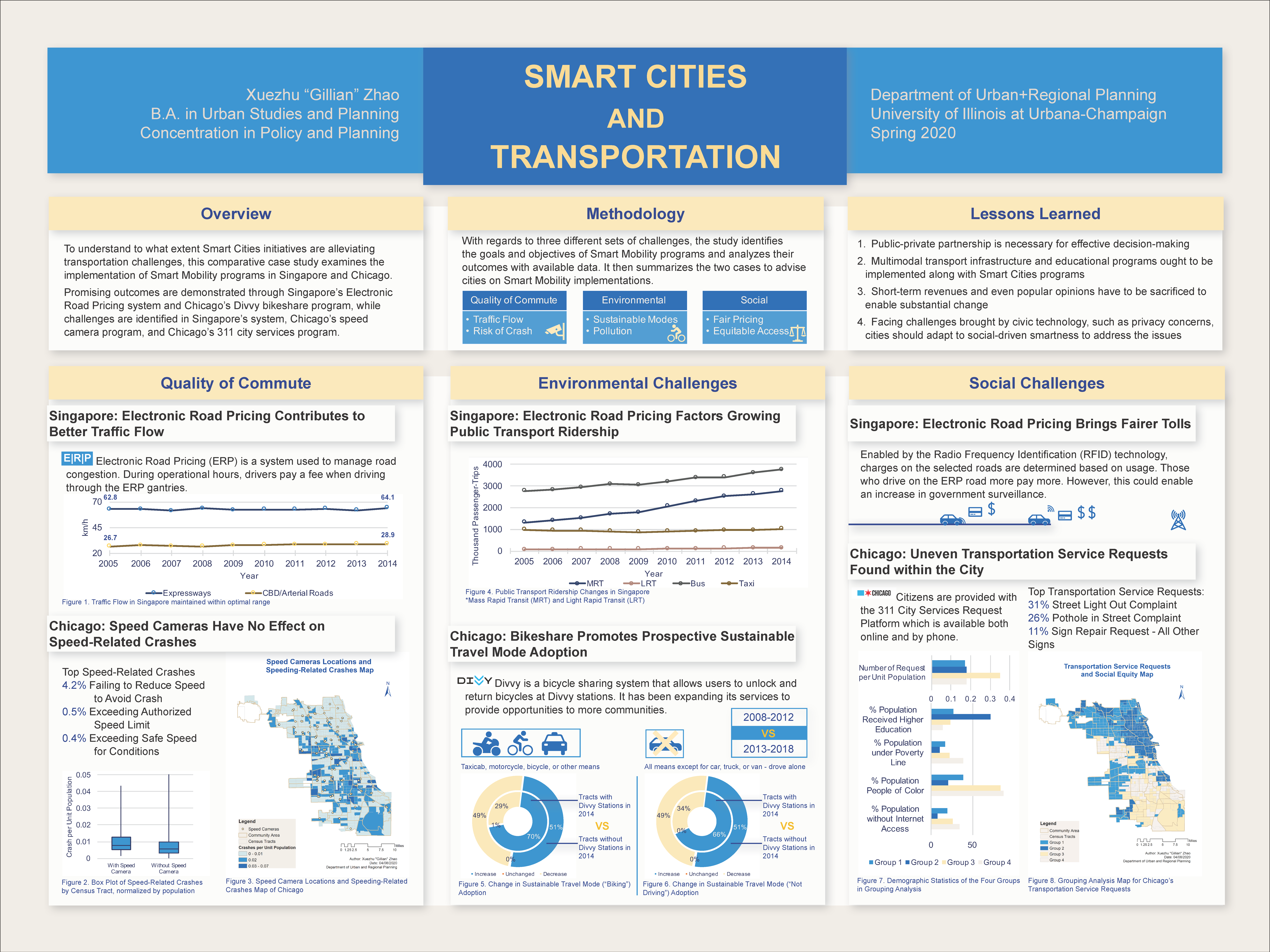
Strategies and Planning: Smart Cities and Transportation, a Comparative Case Study
A study of smart mobility programs in Chicago and Singapore
QGIS
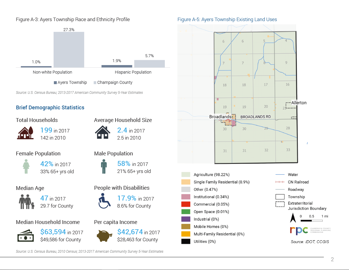
Strategies and Planning: Transportation Factsheet
A sample of factsheet completed for a regional planning commission internship
Transportation Planning
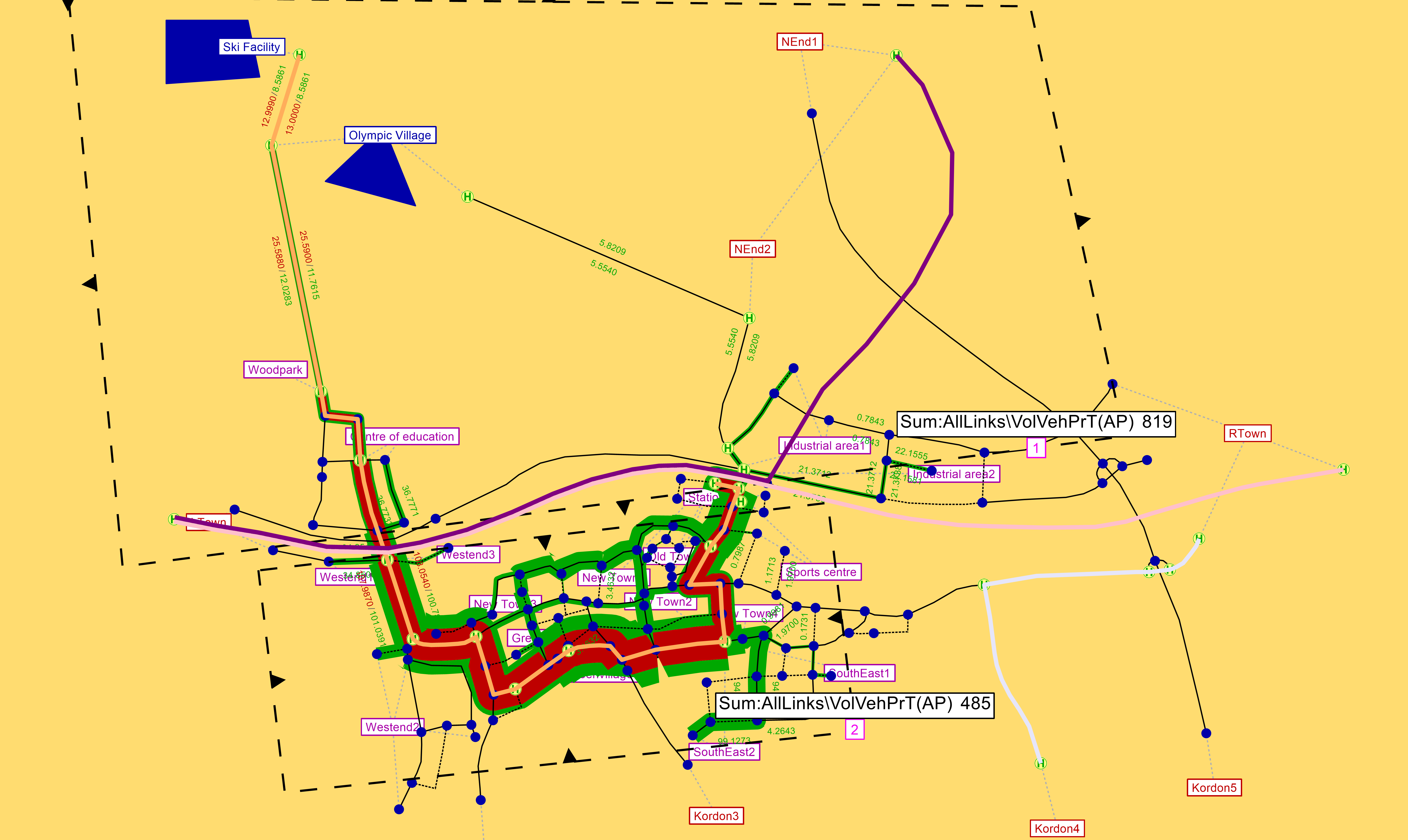
Spatial Analysis: Data-Driven Transportation Planning Methods
A set of lab exercises on standard travel demand modeling
Design
Adobe InDesign
Research and Memo: Urban Growth Modeling for Pittsburgh MSA
A (fictional) growth modeling project which forecasts new development for 2021 through a binary logistic regression model
Spatial Analysis: Flood Inundation Prediction
A environmental risk model that predicts the probability that an area will be inundated with flood water
Strategies and Planning: Transportation Factsheet
A sample of factsheet completed for a regional planning commission internship
Strategies and Planning: Smart Cities and Transportation, a Comparative Case Study
A study of smart mobility programs in Chicago and Singapore
Adobe Illustrator
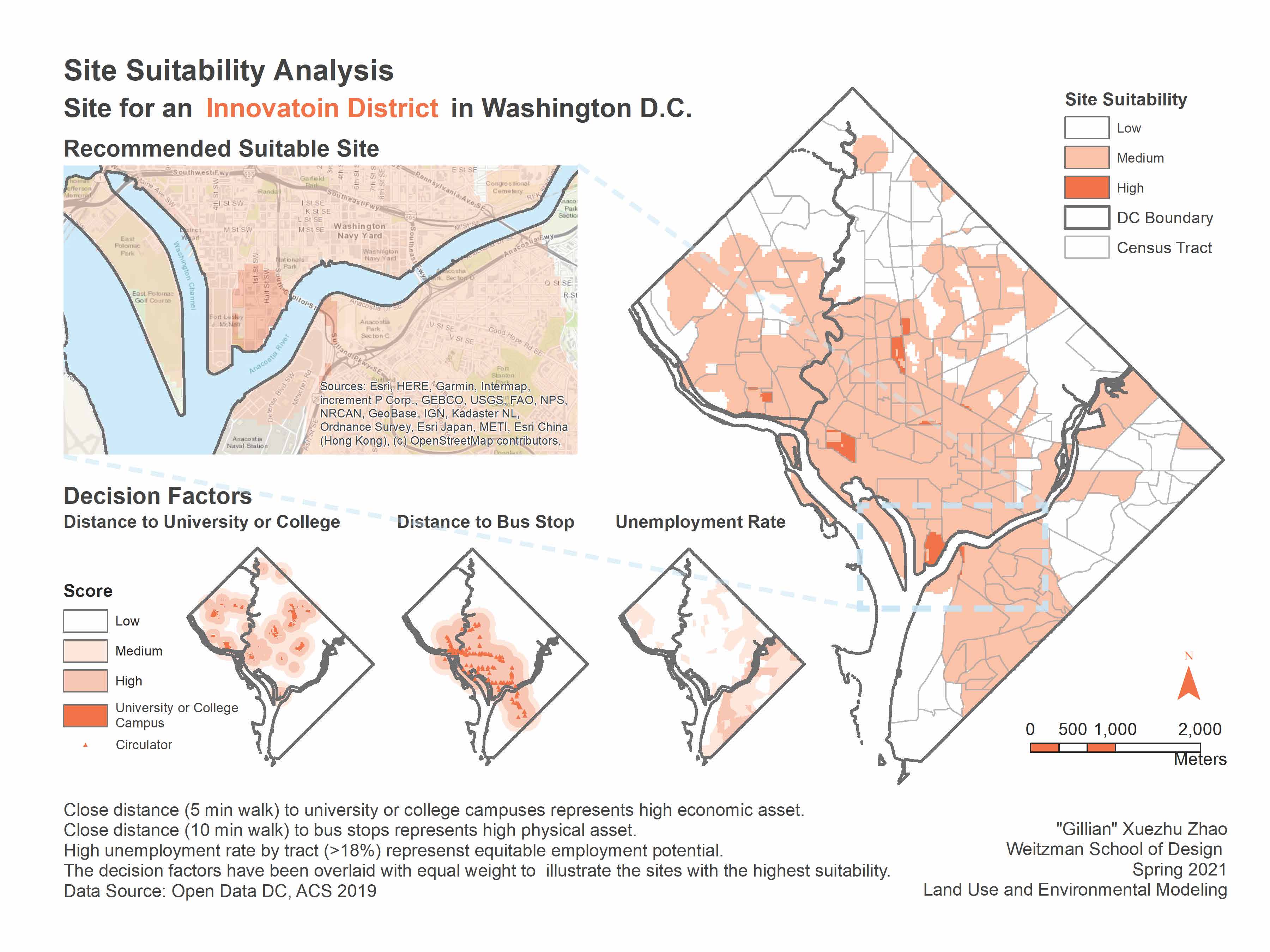
Data Visualization: Site Suitability Analysis
An illustration of site suitability analysis for an innovation district in Washington DC
Adobe Photoshop
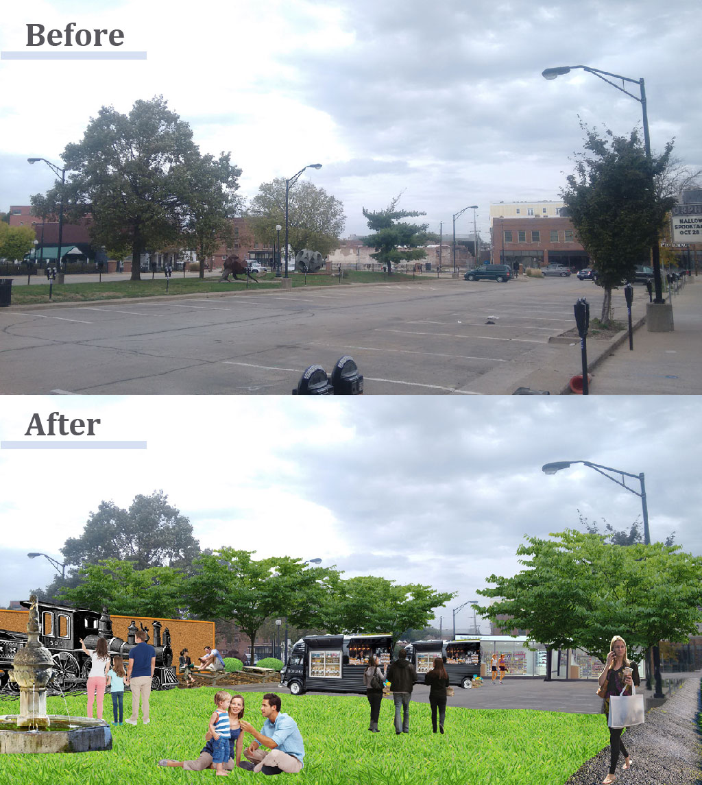
Strategies and Planning: Neil Street Plaza Redevelopment Plan
A plan to develop a ‘railroad plaza’ in downtown Champaign
SketchUp
Strategies and Planning: Midtown Connection Redevelopment Proposal
A mixed-use development proposal featuring a plaza roundabout connecting downtown and campustown in Champaign, IL
Communication
Memo Writing
Research and Memo: Policy Brief / Memo for a Flood Inundation Center
A (fictional) one-page proposal for the creation of a Regional Flood Inundation Modeling & Planning Center (FIMPC)
Research and Memo: Policy Memo for a City-Level Internet Sales Tax
A (fictional) policy memo for the implementation of a city-level internet sales tax
Strategic Planning
Strategies and Planning: A Neighborhood Plan in Atlanta
A neighborhood-level plan for the Adair Park and Pittsburgh neighborhoods surrounding COVID recovery and response
Strategies and Planning: Airport City Strategic Report
A strategic report for the City of Newark and the Port Authority of New York and New Jersey
Strategies and Planning: N Prospect Ave Area Improvement Plan
An Area Improvement Plan for the North Prospect Regional Commercial Center under the anticipated retail climate change challenge
Strategies and Planning: Midtown Connection Redevelopment Proposal
A mixed-use development proposal featuring a plaza roundabout connecting downtown and campustown in Champaign, IL
Strategies and Planning: Neil Street Plaza Redevelopment Plan
A plan to develop a ‘railroad plaza’ in downtown Champaign
Research

Research and Memo: Comparative International History
A comparative analysis on urban redevelopment in America and China
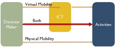
Research and Memo: Literature Review - Impacts of ICTs on Travel Behaviors
A literature review that conducts a framework and provides planning implications regarding travel behaviors influenced by ICTs
More

Writing: Contributer to a Daily News Platform
Drafted some stories for Alternatives Watch, a daily news platform that covers the rapidly evolving world of alternative investments geared toward institutional investors
For more dated projects, please check out my old website