Research and Memo: Flood Inundation Prediction
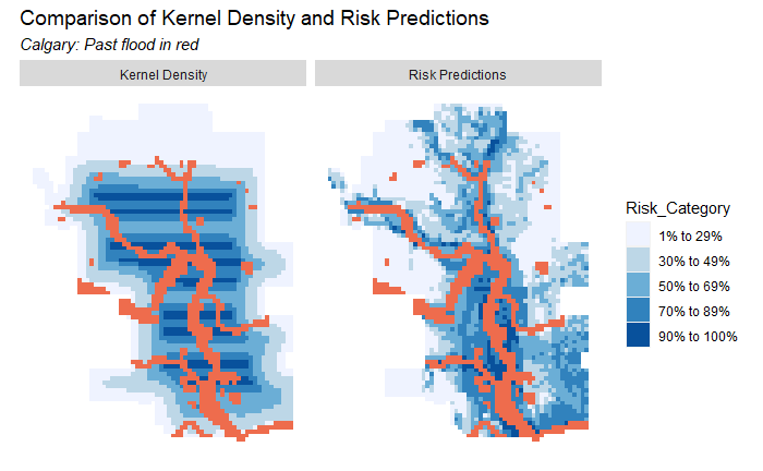
In a team of two, we developed a predictive model that predicts the probability that an area will be inundated with flood water. The report explains the planning motivation as well as illustrate the environment features, model performance, and prediction results.
Specifically, I used hydrology tools in ArcGIS to turn digital elevation models (DEM) into an ordered network of streams and watersheds. From there I was able to create environment and hydrological features such as slope, basin, and distance to downstream. Then in R studio I created fishnet grid areas as well as developed more meaningful variables such as distance to nearest slope and categorized slopes. After my teammate developed and validated the model, I double-checked as well as conducted spatial cross-validation. Finally, I adjusted the visualizations and turned everything into a report in InDesign.
disclamer: this project is a part of a graduate course